Day 1 – 4/28/18
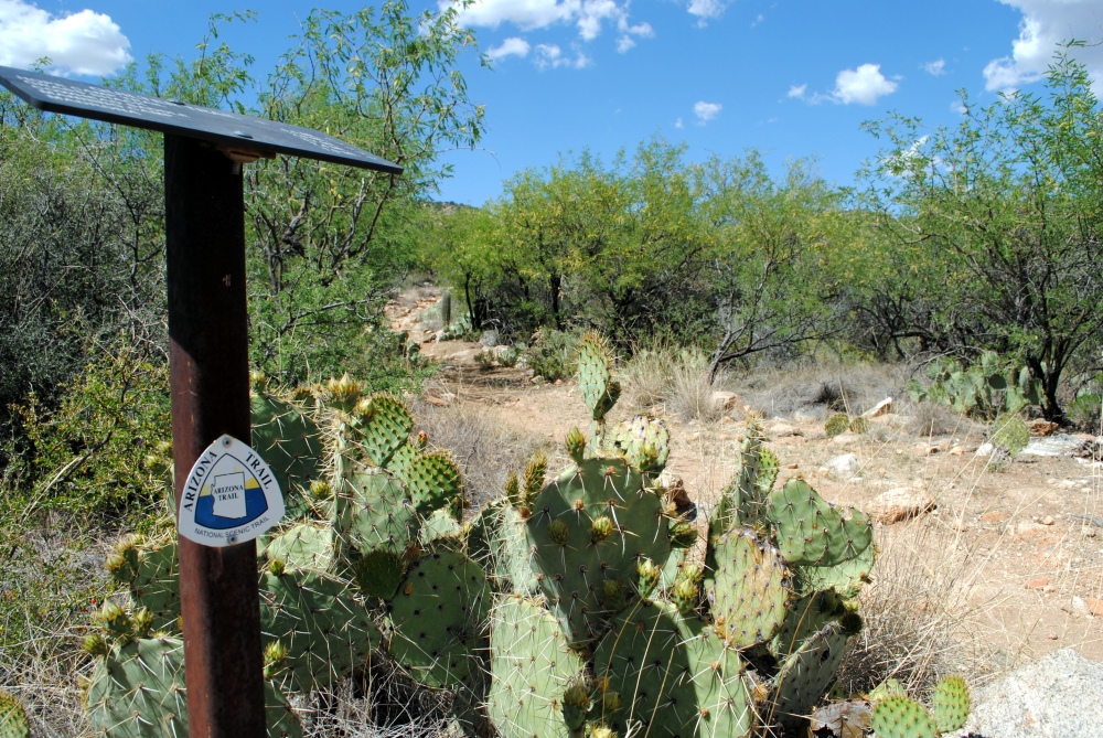
Saguaro National Park To redington Road
24.6 Miles
Hiked 9.8 miles. 7.5 of that was actual Arizona Trail. The other 2.3 was from Loma Alta TH to the AZT.
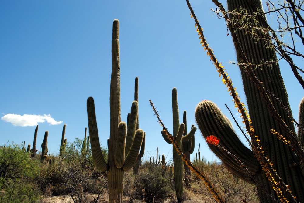
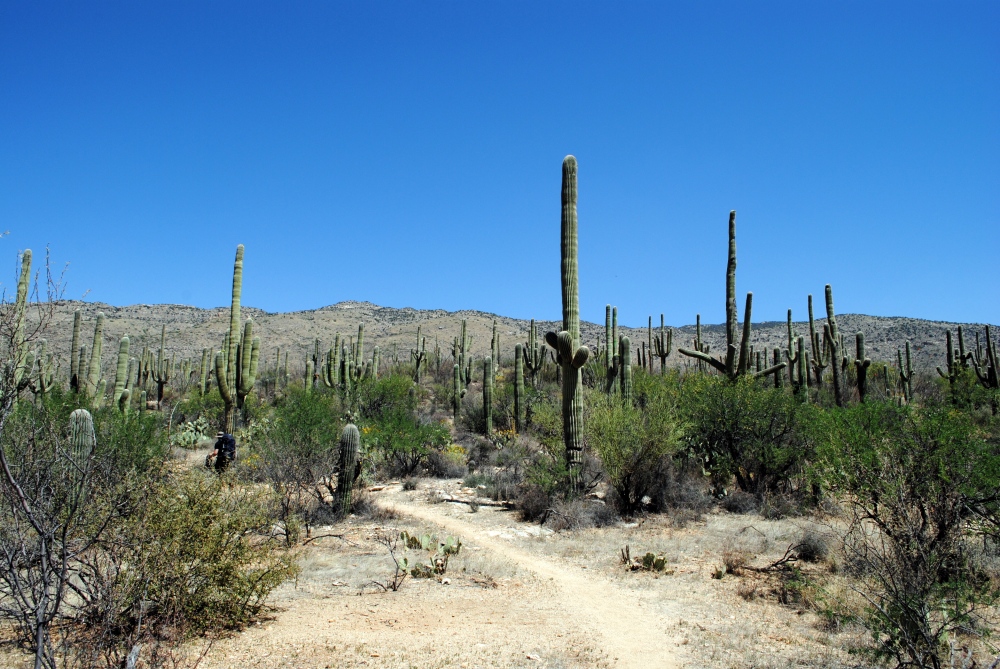
If you haven’t hiked in the Saguaro National Park yet, you’re in for a treat. The park encompasses a lot more than all the majestic Saguaros the eye can see. The park contains six different biotic communities from desert plant life to high altitude pine. Desert scrub, desert grassland, oak woodland, pine/oak woodland, pine forest, and mixed conifer forest. You start off at about 3000 feet in elevation for this passage, and peak at almost 9000 feet. That is approximately an intense 6000 foot elevation gain in just under 14 miles.
I left work early the day before the hike on April 27th, packed up and hit the road by 2:45 in the afternoon. I-10 traffic was backed up and I didn’t meet up with Chris until about 5:45 in Tucson. He got up there early to get our Saguaro NP campsite permits, because the government can’t take advantage of modern technology and just email them to you. We went to a local Italian restaurant that was on Diners, Drive-ins, and Dives called Renee’s Organic Oven. Afterward we drove the curvy, scenic Catalina Highway into the Santa Catalina Mountains to the Gordon Hirabayashi campground. Because I was so late, we set up camp in the dark on the ridiculously hard ground for tent spots. It was like they laid concrete and covered it with gravel and dirt and charged people $10 a site to camp there. I bent a few stakes before abandoning them and using large rocks to weigh the corners of the tent down. Other than that, it wasn’t a bad campground.
I slept fairly well, despite other campers waking us in the middle of the night. Side effects of designated camping sites. We got up around 5 that morning, packed up, and left Chris’ car at the parking area near the road there at Gordon Hirabayashi. We drove the Jeep down the mountain and back into Tucson to an IHOP for breakfast. Big improvement over Awful House. Then we drove to the Redington Road trailhead to leave our water cache. If you follow Tanque Verde Rd east out of Tucson it eventually turns into Redington Road, which is a fairly gnarly drive. You’re going to need ground clearance for this one, and preferably 4-wheel drive.
We left two gallons of water with our initials and use after dates with other jugs of water left by other hikers, public and private, and also hid two gallons underneath the boughs of a nearby Juniper in case someone helped themselves again. After that, we drove back down Redington Road to Old Spanish Trail and over to Camino Loma Alta trailhead where we left the Jeep. We slathered on the sunscreen and geared up and hit the trail. By that time it was 10AM. A much later start than what we wanted to get. That drive on Redington Road to our cache drop took longer than expected.
The 2.3 mile arch of Hope Camp Trail, from where we parked to where it intersects with the AZT with the John “Jake” Quilter memorial plaque, took about an hour. It was already very hot at this point. Maybe in the 90s. It was from there, where the AZT joins the Quilter Trail, we began our trek up the incline of Mica Mountain with the hopes of making it all the way to Manning Camp. It was very slow going through the forest of Saguaro and Ocotillo, although a gradual slope at the start, it inclined drastically. It ended up being one of the longest and toughest hikes we’ve done. We had to take breaks frequently and were going through water faster than we normally would. My back muscles were sore and aching already from earlier in the week, and by the end of this day they were completely sore and stiff. I had trouble looking down or sideways.
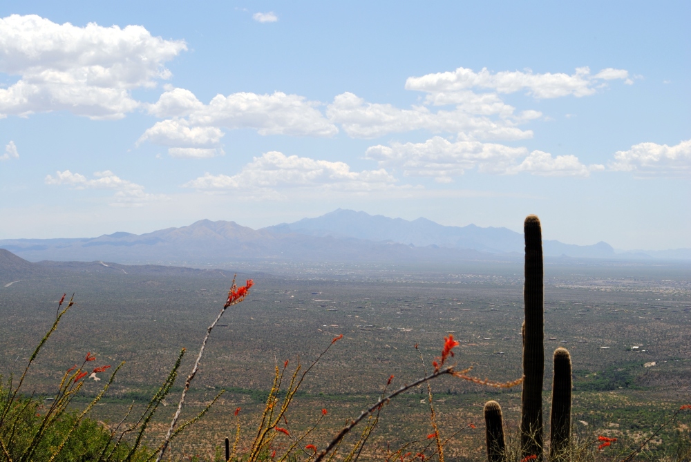
Did I mention it was really hot? The incline was kicking our asses. The trail had a steady climb, then it would level out for a stretch then go right back into a steady climb. We stopped at one point and found refuge from the sun underneath a large, shady Mesquite tree and took a long break. To the east of the trail, Rincon Peak stood as a guiding point. To the south of us, the wide, relatively flat, Rincon valley we traversed the month prior laid out behind us next to Vale with its veins of draws was so easy compared to this. Behind the valley, the Santa Rita Mountains stood high. And behind Santa Rita, The Mount Wrightson Peak stood even taller. Mexico was completely out of sight.
Once we left that spot, the trail dropped us down into this little valley between the hills. We passed these awesome rock spires of geological misplacement among the rest of the landscape, and then walked among a pleasant area of mesquite trees and shade where we intercepted the Manning Camp Trail. This is where the AZT leaves the Quilter Trail and joins the Manning Camp Trail. After that, we climbed up out of this little valley and back up a few short switchbacks. Not long after that we came across a seasonal stream that was not flowing, but still had pools of water in the granite bedrock.
We stopped to refill Chris’ water bottle. He filtered it with his Katadyn. I offered to also put purification tablets in the bottle as well just to make sure to kill an remaining bacteria, since the water was standing and bugs were floating around on the surface. Chris, like the badass he is, just drank it right there. It’s good, he told me. Let’s refill our water, he said. And it was a good thing we did. He was down to half a liter. I still had two. I should have been drinking more, but wasn’t expecting this spot. I was rationing it for the campground.
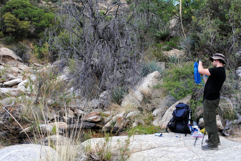
It was here we took another long break while we refilled the camelbaks and bottles. I took two Advil for the increasing pain in my back and shoulders. I also discovered, as I removed my shoes and socks, that the sole of my right Merrell was coming off. I had been feeling a little bit of pain down there on my foot and found out that pebbles were getting in between the sole and the shoe. That sucked. Didn’t have any sort of glue for a temporary fix. Just had to keep stopping from here on out and shake out the pebbles. It sucked because the boots were only a month old at this point. Luckily, after I got back from this trip, Cabela’s exchanged them for a brand new pair.
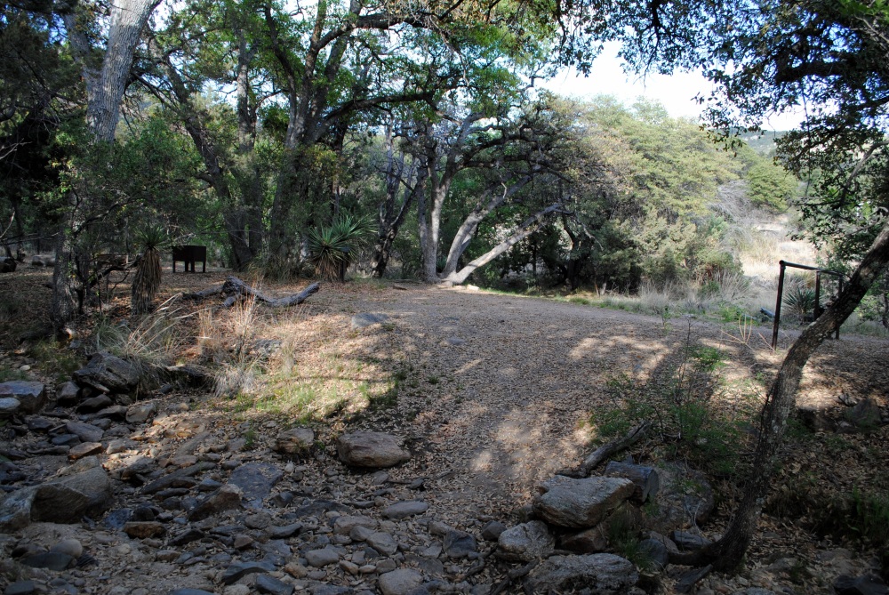
It wasn’t much further to Grass Shack Campground from this point, maybe another 2.5 miles, but it felt like ten. We came to the top of this mountain and the trail took us over large areas of granite rock. The only way to see the trail was to follow the cairns placed on boulders. The trail plateaued and we came to Douglas Springs Trail junction. Only .6 miles until Grass Shack. The trail dropped us down slightly into a thicket of oaks and we came to Grass Shack at about 5 in the evening. It was approximately 5.5 miles to Manning and there was no way we could go on. We were done for the day. Even though our permits were for camp spots at Manning, the rangers said if we decided to stay at Grass Shack instead we just had to call and let them know.
Apparently we weren’t the only ones. There was a party of four other hikers who were doing the same thing. I was talking with the father of the group and he said they had refilled water at the same spot we did back on the trail. They had got to Grass Shack a lot earlier than us and were waiting out the day. He had almost got heat stroke. It was no joke that day. Too damn hot to be climbing mountains with the weight we were carrying.
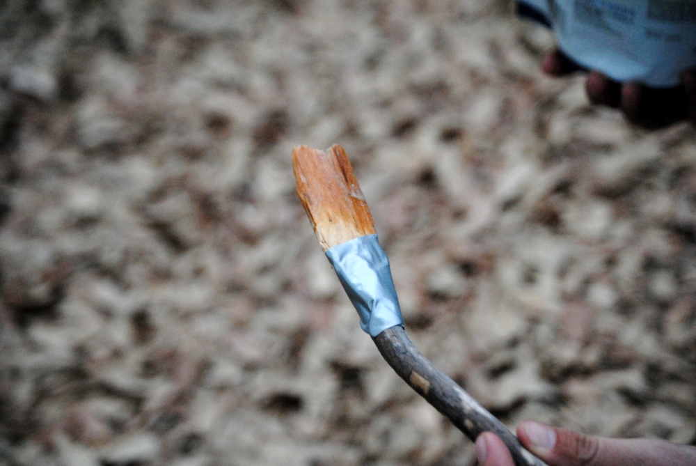
Other than those folks, there was no one else there. It was a beautiful campsite well shaded under the large oak trees and the ground was nice and soft from the dead leaves and grass. There was a stream a few yards from us where the water had come to a trickle. We picked a spot with a bear box and set up camp. Chris went down to the water and refilled his camelbak again and I went to the latrine (an actual porta potty all the way up there) and cleaned up a bit. Then it was time for dinner. Chris forgot his spoon for his mess kit, so he fashioned one out of a stick, a flat chip of wood, and duct tape. Because he’s a badass.
We threw our packs into the bear box and turned in for the night. It had been a long, hard day.


