The Arizona Trail

Passage 33/34 – What the FUTS!

Day 4 – 8/29/17

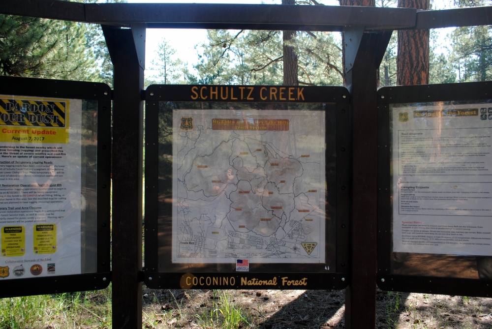
Schultz Creek Trailhead To Schultz Pass Tank

We had about 12 miles left of our hike at this point. We decided to split that 12 miles up into two 6 mile day-hikes with the cheap, $5 day packs we bought at Walmart. This way we could give our feet a break, recover a little, and not have to worry about rushing through the remainder while using the hotel as base camp. You know, enjoy ourselves a little more. It was all Agave’s idea, really. I originally wanted to hike Passages 31 and 32, around Flagstaff, which was why we ended up hiking part of Passage 34, because we left the Jeep at the end of Passage 32. The other reason I wanted to hike around Flagstaff was because a section of Passage 33 was closed off due to logging. So the Flagstaff bypass trail had a bypass trail, which was the Flagstaff Urban Trail System (FUTS).

So, the last two days, we hiked the last little bit of Passage 33 from Schultz Creek Trailhead to where it intersected with Passage 34 to the Jeep at Schultz Pass Tank. Then the last day, from Schultz Creek TH to the Karen Cooper trail of FUTS back to the hotel. It was all a success in the end and we had a lot of fun. And that’s all that matters!

We woke early that Tuesday morning at the hotel even though we tried to sleep in. We had the continental breakfast down in the lobby where they had a machine that made pancakes with the push of a button. It was pretty amazing. I made sure to eat plenty of carbs and protein. And coffee. Always coffee.

My Aunt Janet lives in the area, so she had reached out to me and we arranged a time for her to meet us so she could join us on this six mile day hike. The more the merrier. While waiting for her to meet us, I lanced and drained my blisters again with a sewing needle from a sewing kit Agave got from the front desk. Dirty business, but had to be done.

My Aunt picked us up at the hotel and drove us to the Schultz Creek TH. From there we hiked northbound to my Jeep at Schultz Pass Tank. It was a lot of fun hiking with my Aunt, and educational. She’s knowledgeable of the local vegetation, and we swapped hiking stories, tips, tricks, and ideas as we made the relatively easy stroll through the woods.

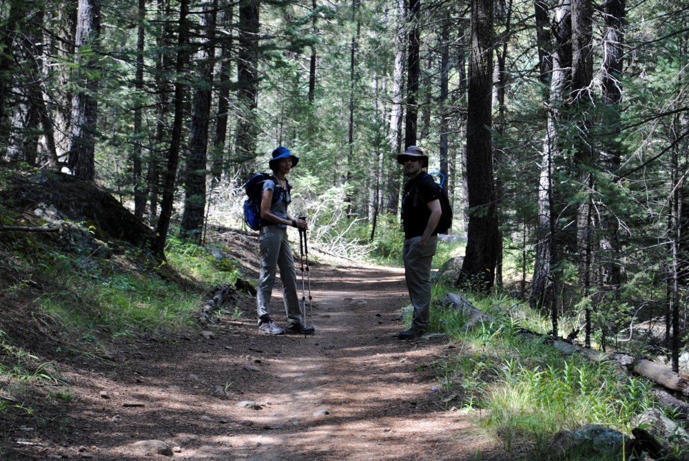
There was little to no incline through this portion of the trail. We were right around 8000 feet the whole time and the much lighter backpacks we carried made it that much easier. The hike took us about three hours to get back to my Jeep. We started about 10AM and were finished by 1PM, which was perfect timing to go grab some lunch in town. It was actually a perfect hike, because as soon as we were done, it started to rain. We got the best part of the day. I drove my Aunt back to her car at Schultz Creek TH and then Agave and I spent the rest of the day eating, drinking and being merry.

At first we attempted to go to a brewery I’ve heard good things about called Wanderlust. They were closed, so we went to Historic Brewing instead. The one on San Francisco Street with the upside down table hanging from the ceiling. It was kind of a preemptive victory burger and beer. I had the aioli burger and fries, and the Joy Rye’d pale ale. After lunch we made a stop at Target so I could get a charger for my fitbit. It had died and I was missing precious steps! Then we went back to the hotel to clean up, hung out for a bit, had dinner at the Denny’s right next door, then turned in for the night.

Upside down table!

Before I turned in, however, I had to attend to me feet again. That little toenail, on the toe next to the big toe, that was protruding up away from the toe? Well it was worse after that day of hiking. Looking at it a little more closely, it wasn’t a dead nail that was falling off. A blister had developed between the toenail and the nail bed and was pushing the toenail up. I took the sewing needle and stabbed it between the toenail and toe and liquid immediately leaked out. It was instant relief as the toenail “deflated,” if you will. I eventually had to tear it off completely because it was only hanging on by the edges of the skin. But have to say, that was a first for me.


Day 5 – 8/30/17

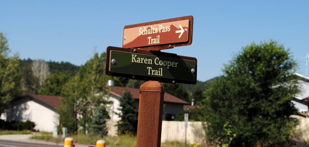
Schultz Creek Trailhead to AZT Butler Ave Intersection

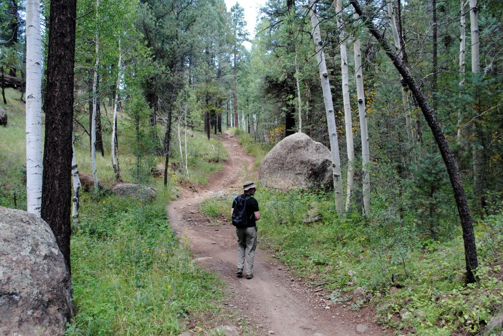
That Wednesday morning we woke up fairly early and had our continental breakfast. Oatmeal and protein. And coffee, of course. We went back up to the room and packed our stuff and loaded it all into the Jeep and checked out of the hotel. My Aunt came by to pick us up and give us a ride to Schultz Creek TH, where we would then head southbound back to the hotel where I left the Jeep parked with all of our stuff. She wasn’t able to join us that day, but that’s ok because she didn’t miss anything special. It was more like a walk through a greenbelt.

From Schultz Creek TH we made our way to the FUTS, which apparently was the Karen Cooper Trail, who was a City Council Member from 2000 to 2008. It was all paved, or maintained gravel, from then on. The trail took us through some nice neighborhoods with beautiful views of Humphreys right from their backyards. We followed it around Frances Short Pond and then down to Wheeler Park, which was a lovely little park inhabited with all kinds of vagrants, drunks, crackheads, and other useful citizens.

We then headed into the old Heritage Square area after rounding the new atrocity of the Hilton hotel they built down there. We found a brewery called Dark Sky Brewing. If you’re ever up that way, go to this place. It is worth it. We ordered some food from the food truck out back and sat inside and talked to the bar tender, the brewer, and some cool folks visiting from Prescott who there to collaborate with the brewery. I had the Blood of My Enemies IPA (because how could you not imbibe the blood of your enemies?), Ring Ring, Hello? and Cirrus NEIPAs. All delicious.

Once we had our fill of food and beer, we proceeded down to Route 66 and headed East towards our hotel. But we had to make another stop first.

AGAVE!

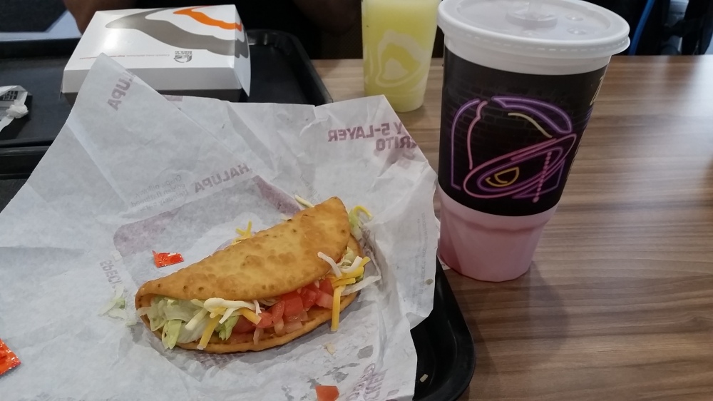
We had to stop at Agave on principal because it was a running joke for the past few days. It actually wasn’t a bad place. Your typical Mexican restaurant. I mean, it was no Taco Bell, but it was OK. We ordered margaritas, because we needed some girl drinks. Mine had jalapenos floating in it and I had to trade with Agave (Chris, not the restaurant) for his mango flavored margarita, because apparently I needed something even more girly. We ordered something called ceviche, which was shrimp cooked with the acidics from lime juice. It was delicious.

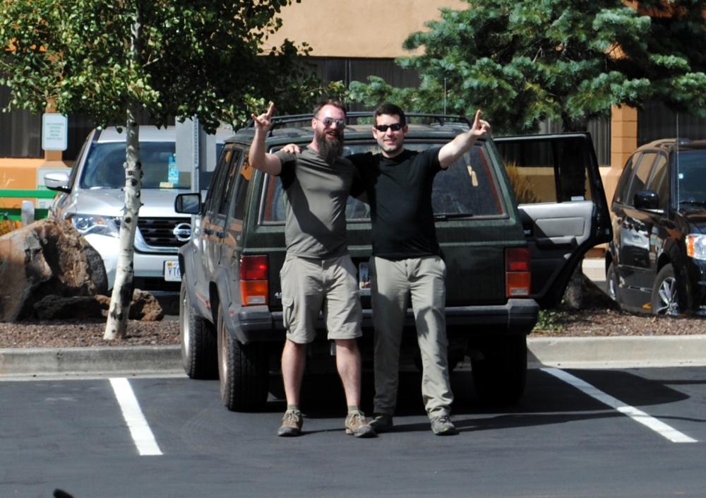
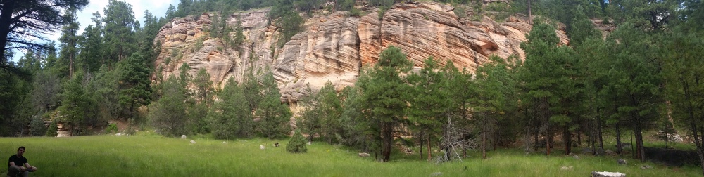
So that was it. We finally tried out Agave, walked back to the hotel, climbed in the Jeep and I drove us back to Chris’ car at Gooseberry Springs Trailhead. We said goodbye and drove home. I took Stoneman Lake Road, which was a pretty nice drive through the woods, especially since it just rained and there was a mist hanging over the meadows. I stopped at a pull off that overlooked Stoneman Lake Village and took some photos. It’s a serene little village that contours the lake and is surrounded by forested hillsides. I changed into a clean shirt and put on my sandals then drove home.


The Arizona Trail

Passage 31: Walnut Canyon to Passage 33: Flagstaff

Day 3 – 8/28/17

Marshall Lake to Flagstaff

We only hiked 6.4 miles of Passage 31 from Marshall lake to the fork in the trail that connects to Passage 33 to Flagstaff.  We left Marshall Lake, the beginning of Passage 31 marked by a brown, steel AZT sign, after we ate and watched the Black Hawk Helicopters fly low over the meadow at about 11:30 AM. We had been hiking for about three and a half hours from Lakeview CG. By this point, my feet were in pretty bad condition, and I started getting pains shooting up from my left knee to my hip, I think because my pack was resting weird or I had too much weight on one side.

We walked in the cover of trees from that point to the base of Walnut Canyon. Dark clouds rolled in and as we walked in silence we listened to the thunder echo off the hills around us. It rained, but we only felt a few drops because of the thick tree canopy. We stopped at the edge of a meadow of long grass and sat underneath the cover of three large Ponderosas and ate lunch of tuna and jerky.

While resting there, I removed my shoes and inspected my feet. I had a blister on the ball of my left foot and could feel the start of blisters on the ball, heel and center of my right. I nearly lost the toenail from the toe next to the big toe from my last long hike from the border. It had turned black, but didn’t fall off. Over time, however, a new toenail was growing in underneath and pushed the dying, blackened nail out. What was left was a thin, translucent, soft toenail. When I inspected my feet there on the trail after we had lunch, that new, soft toenail was sticking almost straight up halfway from the cuticle. I figured it just had not healed all the way, and was falling off.

I took care of the blister I had and the potential blisters that were to develop. I wiped the affected areas with alcohol swabs. I then tried to poke a hole into the blister on my left foot with my pocket knife, but the tip of the utility pocket knife blade was rounded and dull and I didn’t want to tear the skin. So I flipped out the corkscrew on the the other side of the pocket knife and twisted the tip into a soft spot of the blister and let it drain.

I then wiped the area clean after it was flattened out and applied moleskin. Then I wiped the areas clean on the other foot for the potential blisters and applied moleskin there as well. Agave had a small roll of gray duct tape and let me use it to wrap around the balls of my feet and my right heel.

We put our socks and shoes back on and strapped on our packs. I could feel that toenail that was sticking up slightly rubbing against the roof of the shoe. Nothing painful, just a strange sensation every once in a while to remind me that my feet were screwed. Most of the time, the pain on the bottom of my feet took my mind off everything else.

From there to the decent into Walnut Canyon, the hike was relatively flat, or had a slight downgrade. We continued on through the trees, I’d slow way down, and eventually catch up to Agave, who would be sitting on his folding stool with his shoes off, studying the AZT app on his phone. So I’d take my pack off, unfold my stool, and take off my shoes and rest, then he’d be ready to go again. Don’t know how he worked through the pain so easily.

The trail noticeably dropped in elevation the closer we got to the canyon, and we got some great views of Humphreys off in the distance. At approximately 3.5 miles from Marshall Lake the trail starts to drop in elevation, and descends about 540 in just a little over a mile.  At points, the trail was made up of only large, jagged rocks and it was incredibly painful descending in these areas. The trail then follows the crest of the canyon for some time through beautiful, tall, green grass, aspen and pine and oak trees, with wonderful views of the Walnut Canyon walls and Humphreys.

I fell back behind Agave again to take some scenic photos. He was way ahead of me by the time I started the switchbacks down the few hundred feet to the base of Walnut Canyon. Again, by the time I caught up to him, he was sitting on his folding stool next to the trail underneath a large Ponderosa nursing his feet. To my right was a clearing of tall, green grass that lead up to the sandstone walls of the canyon that looked like the Spaceballs ran a comb back and forth across them.

We sat, rested, ate and drank for a minute.  I took more Advil. We were excited and elated to be so close to our end goal. So close to Flagstaff. Back on our feet and hiking along the base of the canyon, it was only a mile before we intersected with the Flagstaff route, Passage 33, that continues through the rest of the canyon and leads out to Flagstaff via road systems. The canyon walls of Walnut turn to hillsides and then fade away as you hike along the double trail out. The trail to the right was worn and beaten down and narrow, the ground on each side of it came up high, almost to my knees. Very difficult to walk with hiking poles since your hands are way above your head at that point. But the trail parallel to it was newer and shallow, so I switched over to that one. The ground on this portion of the trail was softer too, soft sand, and it felt great on my feet.

The further we hiked through this valley we could hear the traffic noise of I-40. Normally this would be annoying, but in this case, it was a welcoming sound letting us know we were close to Flagstaff. We passed signs pointing us toward the Flagstaff Urban Trail System which the AZT would intersect. We encountered a homeless man wandering around out in the forest like the Walking Dead, and then a woman in her thirties walking her Great Dane. We were definitely close to Flagstaff.

We rounded a pond and came to an asphalt paved trail that was S. Babbitt Drive that lead us into the city. It felt weird walking on smooth, flat asphalt and concrete after walking on the rough, jagged rocks of the trail for so long. We collapsed our walking poles and put them away. We followed Babbitt Drive to Butler Avenue, and there on the corner, in bold, neon lights that called to us in the waning light of day was the inviting sign of Taco Bell. Oh that sweet, sweet Mexican-inspired fast food chain.

Inside the restaurant we took off our packs and left them in a booth with our walking poles and proceeded to the counter to order food and drink. I got a beef Chalupa supreme and a large fountain drink, which I filled to the brim with ice and Gatorade. It was so delicious. Agave got a Mexican pizza. I mean, it was no Agave restaurant, the whole motivation for this detour, but it was like eating at a gourmet five-star restaurant. The employees and other customers didn’t seem to care we were dirty, smelly, sweaty hikers dining with them. Probably used to it.

While eating, we called an Uber. As we finished our food and gathered our stuff to wait by the front door for our ride, I heard an older couple say something about the Arizona Trail as we walked by. They were wearing cycling attire and their bikes were attached to their car outside. As we were loading up our packs into the Uber driver’s car the older man came outside and asked if we needed a ride somewhere, and even though it was bad timing, I found it to be incredibly generous and supportive. Here these people were, trail people of their own kind, noticed we were clearly hiking the AZT and wanted to lend us some support. It was heart-warming, and a clear sign of the support in the hiking community. We declined the offer, as our car was already there and we would have got a cancellation fee, but thanked the man anyway. That would never have happened in Phoenix, because Phoenix is filled with meth heads.

Our Uber driver asked what the deal was with the packs. He just moved to Flagstaff from California, so we told him we’ve been hiking a portion of the Arizona Trail. He was not aware of it, so we told him it’s like the PCT, but not as long. He was a super nice guy, looking to buy property in Williams and played guitar at venues in Flag and Ubered for money. It was fully dark out by the time he got us to Walmart. We bought more water, cheap $5 backpacks for our day-hike portions the next two days, deodorant, pants, shirts, and underwear. People looked at us funny while we were in Walmart with a shopping cart full of these huge packs and we were limping around dirty as homeless men. Really, we should have fit right in with the rest of them.

We called another Uber to take us to the Holiday Inn Chris had booked on Huntington Drive. It wasn’t long before we were in our room living like civilized people once again. We used the laundry facilities to wash our sweat-stained clothes, ordered a pizza, watched TV, and bathed. So much dirt washed off of me and ran dark and black as it swirled around the drain. Best of all, we rested our feet and lied in our soft beds until we fell asleep watching TV.